Gibraltar's GeoPortal
What is a Geoportal?
A Geoportal is used to find and access geographic information (geospatial information) and associated geographic services. These services allow the user to display, edit, analyse, and manipulate geographic data via the Internet.
From this site you will be able to access various Geographic web based services including our Map Viewer. New services will be added as they are developed so remember to keep visiting this site to check for new additions.
What is GIS?
GIS means Geographic Information System which is a system for storing and manipulating geographical information using computers. GIS uses range from searching computer based maps and way finding to location based analysis and calculations.
Need Help?
If you require help using any service please visit our help page.
INSPIRE Directive
In Europe a major recent development has been the entering in force of the INSPIRE Directive in May 2007, establishing an infrastructure for spatial information in Europe to support Community environmental policies, and policies or activities which may have an impact on the environment. Read more...
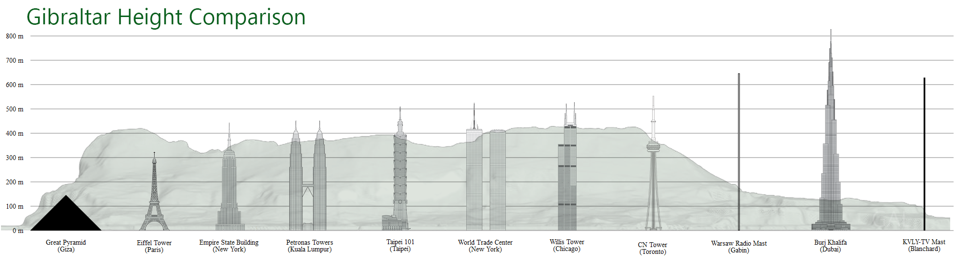
Gibraltar Geo Facts
Latest News
and manipulate geographic data via the Internet using our Map Viewers.
the maximum permitted height for aviation purposes of any structure at a specific point.
Fly around the Rock and check out those hard to reach places.
All rights reserved.