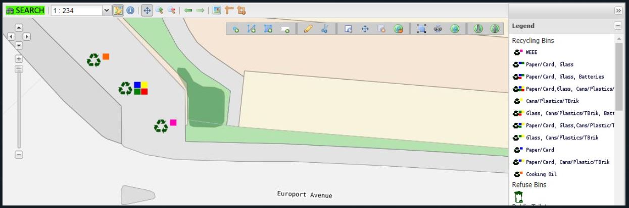
The latest update to the Government’s Geoportal now provides the public with a new layer that illustrates both the locations and classification of recycling bins where geoportal users can identify the most convenient location to deposit their recyclate materials. This interactive layer is colour-coded as per recyclate type identifying blue, yellow, green, pink, orange and red bins.
From this site you will also be able to access various Geographic web based services including the Map Viewer. New services are continually added as they are developed, so remember to keep visiting this site to check for new additions.
The Government Geoportal is the platform where HMGoG provides important geospatial and location data to the public. These services allow users to display, edit, analyse and manipulate geographic data via an internet browser.
The Department of the Environment says it is grateful to its Environmental monitors James for reviewing the sites and enabling the update of types of bins and locations. To access the this page Click Here.